


Hurricane season in the U.S. generally runs from late spring to late fall. In the Atlantic basin, which encompasses the Atlantic Ocean, Caribbean Sea and Gulf of Mexico, most hurricanes occur between June 1 and Nov. 30. Hurricane season for the Eastern Pacific basin, which includes the waters off the nation’s west coast, lasts from May 15 to Nov. 30.
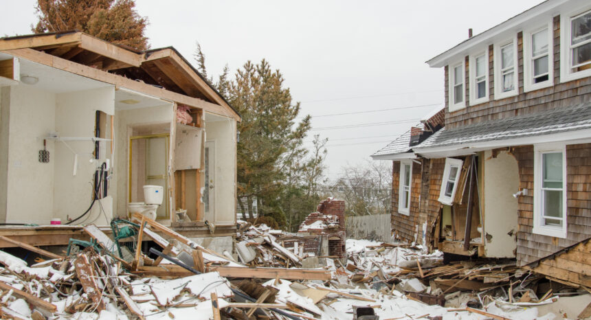
News outlets across the country — especially those in coastline communities — monitor the weather closely during this period, keeping an eye out for tropical storm watches and hurricane warnings. While tropical storms are milder than hurricanes, they are dangerous because they can cause flooding, knock down trees and power lines and wash out roads and bridges. Hurricanes can be catastrophic, destroying homes and businesses and leaving some areas flooded and without power for days to months. For example, Hurricane Katrina in 2005 was responsible for more than 1,800 deaths and an estimated $151 billion in damages, according to a 2015 report from the U.S. Census Bureau.
Journalists role is critical when it comes to reporting on tropical storms and hurricanes. The public relies on news reports for the most up-to-date weather information as well as guidance on how to prepare and when to start preparing for dangerous conditions. In the midst of weather-related emergencies, government agencies look to news organizations for help quickly distributing details about evacuations, school closures, shelters, medical care, transportation, food and clean water.
Reporters who write about weather as part of their beats and even those who only pitch in on such stories occasionally should familiarize themselves with emergency-management procedures in their cities, counties and states. They also should know which local and national organizations monitor weather patterns and issue warnings and advisories. It is a good idea to identify key sources, including media liaisons and press officers, and to establish relationships with these individuals before they are needed.
To help journalists cover this important topic, Journalist’s Resource has compiled a list of reports, tip sheets, research studies and other resources that should be useful to media professionals of various experience levels.
———————–
Understanding weather terms, concepts
The National Hurricane Center (NHC) has put together a glossary of terms related to hurricanes as well as a list of weather-related acronyms.
The NHC also has created an easy-to-understand chart describing the Saffir-Simpson Hurricane Wind Scale, a 1-to-5 rating system that is based on a hurricane’s sustained wind speed and is used to estimate potential property damage. This scale can help journalists differentiate between Category 3 and Category 5 hurricanes.
The center’s website offers a detailed explainer on storm surges, which can cause extensive damage.
Historical context
The NHC has compiled data on major hurricanes since 1900, with details such as death tolls, local economic impacts and interactive maps for each hurricane.
A free online tool from the National Oceanic and Atmospheric Administration (NOAA) allows you to enter a zip code and access more than 150 years of Atlantic hurricane tracking data for a specific area.
The U.S. Census Bureau has gathered data and reports related to Hurricane Katrina, the deadliest U.S. hurricane since 1928.
A 2006 report from the U.S. Centers for Disease Control and Prevention (CDC) and Journal of Safety Research looks at non-fatal injuries among residents and relief workers in the aftermath of Hurricane Katrina.
Building weather maps
Storybench, part of the Media Innovation program at Northeastern University’s School of Journalism, offers step-by-step instructions on using the online mapping tool CartDB in a guide titled “How to Build a Weather Map in CartoDB.”
Tools for authenticating photos and videos
Before, during and after big storms, people will share lots of photos and videos on social media. Some will be so compelling, reporters will want to use them in their coverage. Beware of altered images as well as photos and videos that capture actual scenes — but from a different time or place.
To check a photo, use a tool like the RevEye Reverse Image Search, which searches Google, Bing, Yandex, TinEye and Baidu for other copies of the image. Use YouTube DataViewer to get information about videos hosted on YouTube, including exact upload time.
Tips on writing weather stories
“How to Build a Better Weather Story: Tips for Reporting Before, During and After the Storm”
This guide from Investigative Reporters & Editors highlights important steps to covering hurricanes and storms.
“Writing the Weather Story: A Step-by-Step Guide”
This explainer from Mark Leccese, a journalism professor at Emerson College, appears on Boston.com.
“Weather Reporting as Beat Journalism”
Scott Libin, a former news director at WCCO-TV in Minneapolis, wrote this tip sheet for The Poynter Institute.
This 40-page guide from the Dart Center for Journalism & Trauma at Columbia Journalism School is aimed at helping reporters improve their coverage of natural disasters and other tragedies.
Federal agency resources
National Oceanic and Atmospheric Administration (NOAA)
NOAA, which is part of the U.S. Department of Commerce, monitors hurricanes as they form and works with various agencies to help communities prepare for dangerous weather. Each year, NOAA’s Climate Prediction Center offers hurricane-season predictions for the Atlantic, eastern Pacific and central Pacific basins.
National Hurricane Center (NHC)
This is a division of NOAA that focuses on hurricanes. Its website offers a host of resources that can be helpful to journalists, including five-day weather outlooks, satellite images and a latitude-longitude distance calculator.
Also affiliated with NOAA, this agency’s mission is to “provide weather, water, and climate data, forecasts and warnings for the protection of life and property and enhancement of the national economy.” It has 122 weather forecast offices located throughout the U.S. Annually, it issues about 1.5 million forecasts and 50,000 weather-related warnings.
This government website offers information about how the public should react when the National Weather Service issues an alert for a hurricane watch or warning. It offers, among other things, tips on what to do when a hurricane is 36 hours from arriving and when a hurricane is just six hours away.
U.S. Centers for Disease Control and Prevention (CDC)
The CDC website offers guidance on preparing for hurricanes, including collecting supplies, getting the family car ready and determining whether or not to evacuate.
Federal Emergency Management Administration (FEMA)
FEMA, part of the U.S. Department of Homeland Security, helps coordinate government responses to national disasters, including major hurricanes.
The federal agency’s website warns travelers of the dangers of visiting parts of the world that often experience hurricanes and other dangerous weather conditions. It includes a chart of storm seasons across the globe.
A sampling of hurricane-related research studies
“Potential Increases in Hurricane Damage in the United States: Implications for the Federal Budget”
Dinan, Terry; et al. Working paper prepared for the Congressional Budget Office, June 2016.
Summary: “Damage from hurricanes is expected to increase significantly in the coming decades because of the effects of climate change and coastal development. In turn, potential requests for federal relief and recovery efforts will increase as well. The Congressional Budget Office has estimated the magnitude of the increases in hurricane damage and the associated amounts of federal aid if historical patterns hold. In addition, CBO examined three approaches to reducing the amount of such federal assistance: limiting greenhouse gas emissions; shifting more costs to state and local governments and private entities, thereby reducing coastal development; and investing in structural changes to reduce vulnerability to hurricanes. The accompanying working paper provides a detailed discussion of the data and methodology CBO used to estimate hurricane damage.”
“Danger and Dementia: Caregiver Experiences and Shifting Social Roles During a Highly Active Hurricane Season”
Christensen, Janelle J.; Castañeda, Heide. Journal of Gerontological Social Work, 2014, Vol. 57. doi: 10.1080/01634372.2014.898009.
Abstract: “This study examined disaster preparedness and decision-making by caregivers of community-dwelling persons diagnosed with Alzheimer’s or a related dementia (ADRD). Interviews were conducted with 20 caregivers in South Florida. Twelve of these interviews include caregiving experiences during the highly active 2004–2005 hurricane seasons. Results indicate that persons in earlier stages of ADRD can, and often do, remain engaged in the disaster preparation and planning process. However, during the early stages, persons may also resist evacuation, even if the caregiver felt it was necessary. During later stages of the disease, caregivers reported less resistance to disaster-related decisions, however, with the trade-off of less ability to assist with preparation.”
“Who Leaves and Who Stays? A Review and Statistical Meta-Analysis of Hurricane Evacuation Studies”
Huang, Shih-Kai; Lindel, Michael K.; Prater, Carla S. Environment and Behavior, 2015. doi: 10.1177/0013916515578485.
Abstract: “This statistical meta-analysis (SMA) examined 38 studies involving actual responses to hurricane warnings and 11 studies involving expected responses to hypothetical hurricane scenarios conducted since 1991. The results indicate official warnings, mobile home residence, risk area residence, observations of environmental (storm conditions) and social (other people’s behavior) cues, and expectations of severe personal impacts, all have consistently significant effects on household evacuation. Other variables — especially demographic variables — have weaker effects on evacuation, perhaps via indirect effects. Finally, the SMA also indicates that the effect sizes from actual hurricane evacuation studies are similar to those from studies of hypothetical hurricane scenarios for 10 of 17 variables that were examined. These results can be used to guide the design of hurricane evacuation transportation analyses and emergency managers’ warning programs. They also suggest that laboratory and internet experiments could be used to examine people’s cognitive processing of different types of hurricane warning messages.”
“Evacuation During Hurricane Sandy: Data from a Rapid Community Assessment”
Brown, Shakara; Parton, Hilary; Driver, Cynthia; Norman, Christina. PLoS Currents, 2016. doi: 10.1371/currents.dis.692664b92af52a3b506483b8550d6368.
Summary: “In anticipation of Hurricane Sandy in 2012, New York City officials issued mandatory evacuation orders for evacuation Zone A. However, only a small proportion of residents complied. Failure to comply with evacuation warnings can result in severe consequences including injury and death. To better ascertain why individuals failed to heed pre-emptive evacuation warnings for Hurricane Sandy, we assessed factors that may have affected evacuation among residents in neighborhoods severely affected by the storm.”
“The Economic Impact of Hurricane Katrina on its Victims: Evidence from Individual Tax Returns”
Deryugina, Tatyana; Kawano, Laura; Levitt, Steven. Working paper for the National Bureau of Economic Research, November 2014. doi: 10.3386/w20713.
Abstract: “Hurricane Katrina destroyed more than 200,000 homes and led to massive economic and physical dislocation. Using a panel of tax return data, we provide one of the first comprehensive analyses of the hurricane’s long-term economic impact on its victims. Katrina had large and persistent impacts on where people live; small and mostly transitory impacts on wage income, employment, total income, and marriage; and no impact on divorce or fertility. Within just a few years, Katrina victims’ incomes fully recover and even surpass that of controls from similar cities that were unaffected by the storm. The strong economic performance of Katrina victims is particularly remarkable given that the hurricane struck with essentially no warning. Our results suggest that, at least in this particular disaster, aid to cover destroyed assets and short-run income declines was sufficient to make victims financially whole. Our results provide some optimism regarding the costs of climate-change driven dislocation, especially when adverse events can be anticipated well in advance.”
Journalist’s Resource thanks David Beard, a research fellow at the Shorenstein Center and former digital news executive at the Washington Post and Boston Globe, for his help creating this tip sheet.
Expert Commentary